
CHARLESTON BATTERY: From Marsh to Mansions

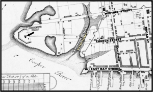
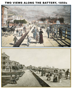
“THE BATTERY” is the common name used in Charleston to describe the pair of man-made seawalls that border the eastern and southern tips of the Charleston peninsula. The “High Battery” is just over 1,400 feet long and was built in the early 1800s which led to the creation of what is now East Battery Street and White Point Garden. The “Low Battery” was a twentieth century expansion of the original Battery that runs an additional 5,000 feet in length that was built in the early twentieth century along the Ashley River on what is now named Murray Boulevard. These “Batteries” provide a panoramic view of Charleston harbor and the adjacent islands, and are a “must see” for any tourists who visit the city.

The Battery. Photo by Willie Harper
The original Battery was constructed on non-existent land, built along the low tide mark of the Charleston harbor and the Ashley River. The goal was to enhance the beauty of the area, create a barrier to blunt storm surges, and, ultimately, create new useable (and taxable) property. When Charles Town was founded, the settlers first built upon the high ground on the peninsula and in early records the term “White Point” was used to describe the land south of Vanderhorst Creek (today’s Water Street) that was “washed by the tides.” About thirty per cent of the peninsula was “low land.”
Broughton’s Battery @ White Point
In April 1725, the South Carolina Provincial Assembly ordered the owners of the sandy land at White Point to stake out their waterfronts with a line of wooden pilings and ballast stones, and began the decades-long process of creating a hard line between the water and dry land. In 1738, the city completed Broughton’s Battery, a double-row of wooden pilings along the waterfront. Within a decade they city had completed an earthen wall and military gun battery along White Point, which unfortunately, was destroyed by the 1757 hurricane.
German-born engineer, William De Brahm was hired to design and construct new fortifications around White Point and in the 1750s hundreds of laborers built massive banks of earth that finally formed a high, solid wall around the perimeter of White Point, from Granville Bastion (currently the Missroon House, Historic Charleston Foundation) stands south to Broughton’s Battery, and then westward to the south end of Legare Street. Dozens of cannon were mounted along the wall to protect the southern edge of the harbor.
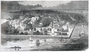
White Point Garden. Courtesy of Library of Congress
During the 1790s, construction of the wall continued. The city constructed square “hog pens” of palmetto logs filled with ballast stone to weigh them down, and for the next two decades the city used granite blocks from the northern states to extend the seawall into the marsh and mud. In 1836, Charleston City Council proposed transforming the vacant expanse behind the Battery into a public pleasure garden called White Point Garden. After completing the landscaping of the area with fill dirt, planting trees and shrubs, White Point Garden opened to the public in 1838.
Images courtesy of New York Public Library